
Sector
Climate
Industry
Climate tech
Business model
B2B
B2G
SaaS
Technology
AI / ML
Drones
Geographic Information Systems
Location
Ernakulam, Kerala
Founded
2026
Team
D
DIPTESH GOUR
Founder
O
ONKAR MAL
Mentor
Product 1
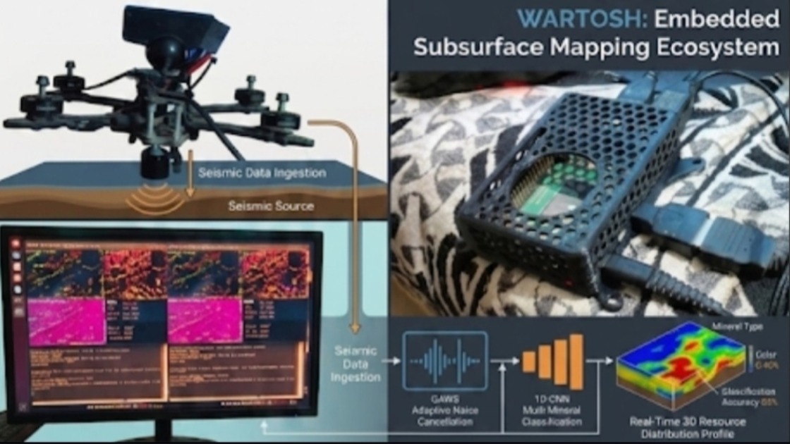 Wartosh
 develops an autonomous UAV-mounted acoustic sensing pod that captures ground wave reflections mid-air. Leveraging proprietary QAWS noise filtering (+18 dB SNR) and INT8 1D-CNN edge inference, it generates high-resolution 3D subsurface voxel models for mining and geotechnical exploration without drilling or physical ground contact
Sector
Climate
Industry
Climate tech
Model
B2B
B2G
SaaS
Technology
AI / ML
Drones
Geographic Information Systems
- Product Concept: Wartosh is an autonomous, UAV-integrated acoustic sensing system engineered for non-contact subsurface geological mapping and structural imaging.
- Core Hardware Stack: A custom multi-channel piezoelectric (PZT) sensor pod integrated with a low-noise 24-bit Analog Front-End (AFE) that measures elastic ground wave reflections mid-air during low-altitude aerial passes.
- Acoustic Noise Rejection: Proprietary QAWS (Quantum-inspired Acoustic Wave Sensing) algorithm dynamically filters drone rotor downwash and airborne clutter, delivering an operational +18dB SNR improvement.
- Edge Compute Engine: Dual-core ARM Cortex-M7 running FreeRTOS and an INT8-quantized 1D-CNN, executing trace inference in under 15ms at sub-2.5W power consumption.
- Data Output & Integration: Direct conversion of acoustic reflection data into high-resolution 3D subsurface voxel models, fully compatible with standard mining CAD engines such as Datamine, Micromine, and Surpac.
- Primary Applications: Open-cast and underground mining boundary profiling, geotechnical slope stability analysis, shallow fault and void hazard detection, and non-destructive infrastructure assessment.
Sector
Climate
Industry
Climate tech
Model
B2B
B2G
SaaS
Technology
AI / ML
Drones
Geographic Information Systems